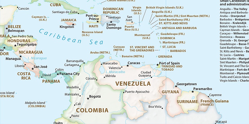
Bahia Kai, (cove(s)) is located in Netherlands (America). It is placed in GMT-4 time zone with current time of 12:28 PM, Thursday. Offset from your time zone: minutes.
| Latitude | 

|
|
| decimal | 12.10721 | |
| DMS | 12° 6' 25.956" N | |
| Distances from | ||
| North pole | 8660.9 km | |
| Equator | 1346.2 km | |
| South pole | 11353.3 km | |
| Longitude | 
|
|
| decimal | -68.21071 | |
| DMS | 68° 12' 38.556" W | |
| Distance from prime meridian: 7393.4 km to West |
||
List of nearest places sort by population
Oostburg 7690.9 km 56°56°56°56°56°56°56°56°56°56°

Marker is showing location of Bahia Kai on map(s). You can click on marker if you want to hide it.
 T: 0.00608 s.
2026 © Location.zone | Terms of use | Contact
 182°
182° 54°
54° 279°
279° 251°
251°