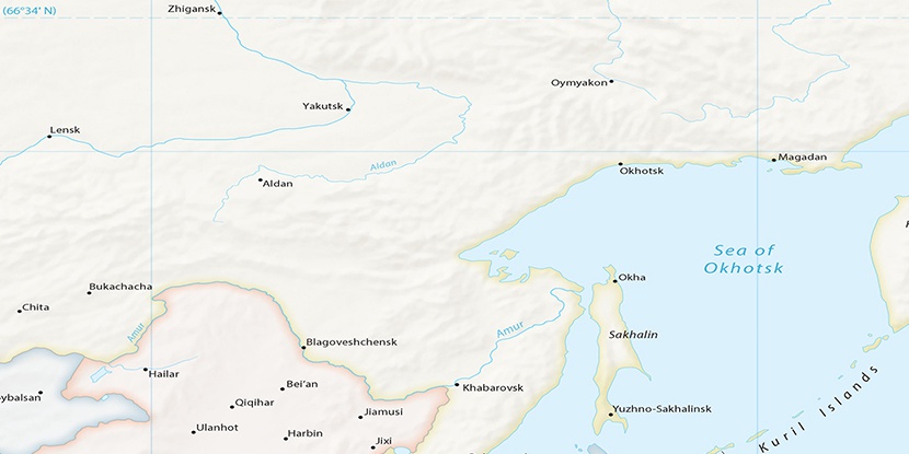
Razvaliny Chapa, (ruin(s)) is located in Amur, in Russia (Asia). It is placed in GMT+9 time zone with current time of 07:16 AM, Sunday. Offset from your time zone: minutes.
| Latitude | 

|
|
| decimal | 55.64248 | |
| DMS | 55° 38' 32.928" N | |
| Distances from | ||
| North pole | 3820.2 km | |
| Equator | 6186.9 km | |
| South pole | 16193.9 km | |
| Longitude | 
|
|
| decimal | 129.34307 | |
| DMS | 129° 20' 35.052" E | |
| Distance from prime meridian: 6820.5 km to East |
||
List of nearest places sort by population
Neryungri 312.7 km 291°
291° 259°
259° 212°
212° 223°
223° 296°290°292°214°214°
 243°
243°

Marker is showing location of Razvaliny Chapa on map(s). You can click on marker if you want to hide it.
 T: 0.02391 s.
2026 © Location.zone | Terms of use | Contact
 270°
270° 160°
160° 168°
168° 122°
122°