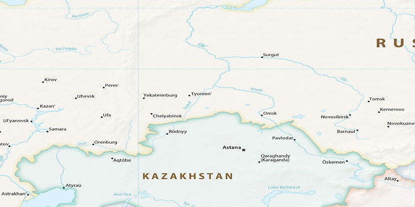
Kuma, (stream) is located in Khanty-Mansiyskiy Avtonomnyy Okrug, in Russia (Asia). It is placed in GMT+5 time zone with current time of 04:21 AM, Friday. Offset from your time zone: minutes.
| Latitude | 

|
|
| decimal | 59.54806 | |
| DMS | 59° 32' 53.016" N | |
| Distances from | ||
| North pole | 3385.9 km | |
| Equator | 6621.1 km | |
| South pole | 16628.2 km | |
| Longitude | 
|
|
| decimal | 66.76417 | |
| DMS | 66° 45' 51.012" E | |
| Distance from prime meridian: 3600.8 km to East |
||
List of nearest places sort by population
Tobol’sk 172.8 km 150°
150° 300°
300° 277°
277° 116°
116° 110°149°
 72°
72° 240°
240° 186°
186° 227°
227°

Marker is showing location of Kuma on map(s). You can click on marker if you want to hide it.
 T: 0.02299 s.
2026 © Location.zone | Terms of use | Contact
 256°
256° 271°
271° 141°
141° 248°
248° 213°
213°