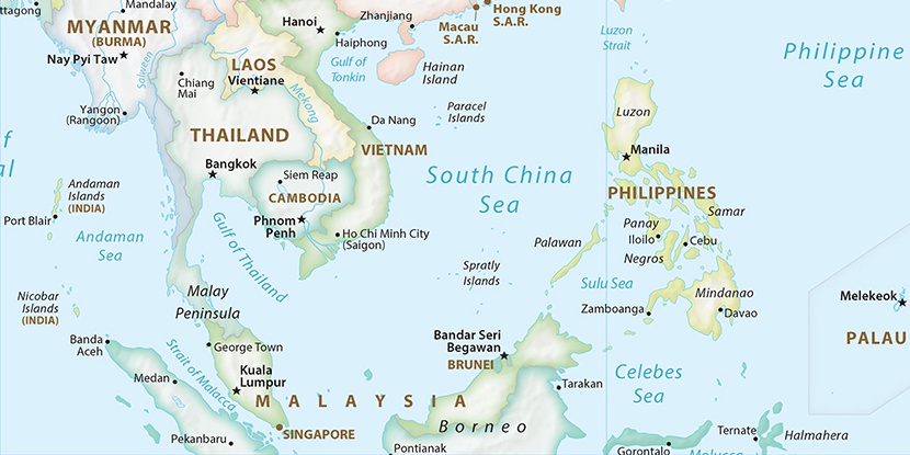
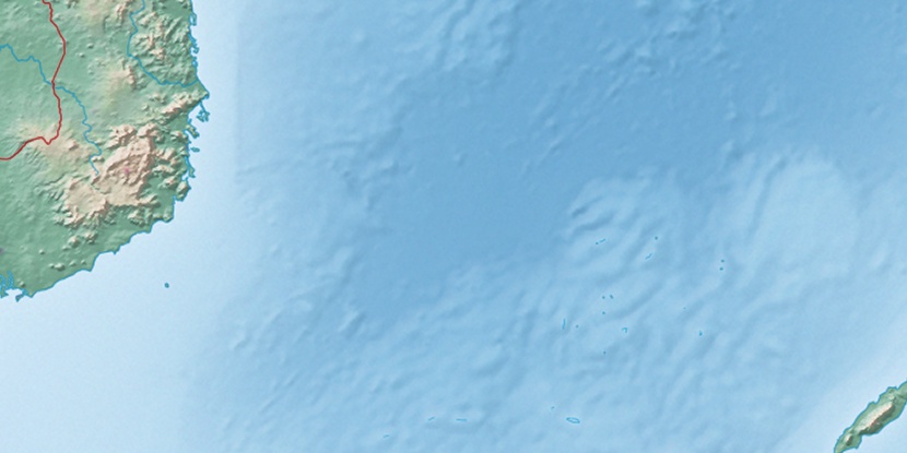
Taiping Island Airport, (airport) is located in China (Asia). It is placed in GMT+8 time zone with current time of 11:29 AM, Thursday. Offset from your time zone: minutes.
| Latitude | 

|
|
| decimal | 10.37788 | |
| DMS | 10° 22' 40.368" N | |
| Distances from | ||
| North pole | 8853.1 km | |
| Equator | 1153.9 km | |
| South pole | 11161 km | |
| Longitude | 
|
|
| decimal | 114.36633 | |
| DMS | 114° 21' 58.788" E | |
| Distance from prime meridian: 12399.2 km to East |
||
List of nearest places sort by population
Zhongshan 1282.3 km 341°340°338°337°
 329°338°337°335°335°334°

Marker is showing location of Taiping Island Airport on map(s). You can click on marker if you want to hide it.
 T: 0.00692 s.
2026 © Location.zone | Terms of use | Contact
 17°
17° 3°
3° 355°
355° 10°
10° 42°
42° 141°
141° 306°
306° 297°
297° 293°
293° 104°
104°