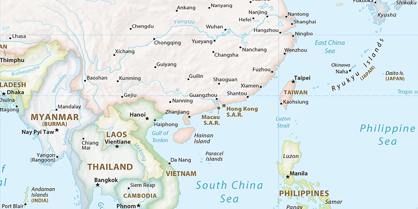
Changhua Gang, (harbor(s)) is located in Hainan, in China (Asia). It is placed in GMT+8 time zone with current time of 11:40 AM, Thursday. Offset from your time zone: minutes.
| Latitude | 

|
|
| decimal | 19.32436 | |
| DMS | 19° 19' 27.696" N | |
| Distances from | ||
| North pole | 7858.4 km | |
| Equator | 2148.7 km | |
| South pole | 12155.7 km | |
| Longitude | 
|
|
| decimal | 108.66113 | |
| DMS | 108° 39' 40.068" E | |
| Distance from prime meridian: 11130.5 km to East |
||
List of nearest places sort by population
Haikou 193.4 km 65°66°
 10°
10° 143°66°
 54°12°72°
 107°
107° 58°
58°

Marker is showing location of Changhua Gang on map(s). You can click on marker if you want to hide it.
 T: 0.00599 s.
2026 © Location.zone | Terms of use | Contact
 44°
44° 17°
17° 349°
349° 339°
339° 303°
303° 293°
293° 252°
252°