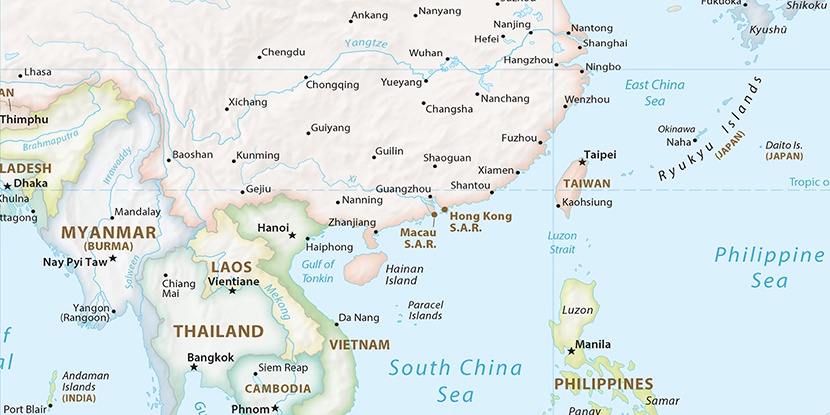
Duntou Gang, (harbor(s)) is located in Hainan, in China (Asia). It is placed in GMT+8 time zone with current time of 09:48 AM, Thursday. Offset from your time zone: minutes.
| Latitude | 

|
|
| decimal | 19.15677 | |
| DMS | 19° 9' 24.372" N | |
| Distances from | ||
| North pole | 7877 km | |
| Equator | 2130 km | |
| South pole | 12137.1 km | |
| Longitude | 
|
|
| decimal | 108.66841 | |
| DMS | 108° 40' 6.276" E | |
| Distance from prime meridian: 11146.7 km to East |
||
List of nearest places sort by population
Haikou 201.2 km 60°61°
 9°
9° 139°61°
 50°11°
 65°
65° 102°51°

Marker is showing location of Duntou Gang on map(s). You can click on marker if you want to hide it.
 T: 0.00616 s.
2026 © Location.zone | Terms of use | Contact
 43°
43° 17°
17° 349°
349° 340°
340° 304°
304° 294°
294° 252°
252°