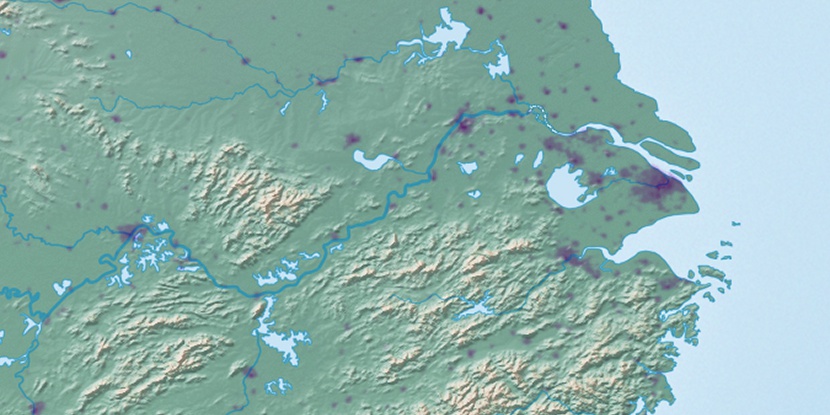
Chang Pu Chiang (historical), (hill) is located in Hubei, in China (Asia). It is placed in GMT+8 time zone with current time of 03:27 PM, Thursday. Offset from your time zone: minutes.
| Latitude | 

|
|
| decimal | 30.00262 | |
| DMS | 30° 0' 9.432" N | |
| Distances from | ||
| North pole | 6671.1 km | |
| Equator | 3336 km | |
| South pole | 13343 km | |
| Longitude | 
|
|
| decimal | 115.3464 | |
| DMS | 115° 20' 47.04" E | |
| Distance from prime meridian: 10459.8 km to East |
||
List of nearest places sort by population
Huangshi 39.5 km 313°
313° 117°
117° 130°311°
 259°313°
 72°
72° 350°
350° 18°
18° 283°
283°

Marker is showing location of Chang Pu Chiang (historical) on map(s). You can click on marker if you want to hide it.
 T: 0.00916 s.
2026 © Location.zone | Terms of use | Contact
 76°
76° 4°
4° 9°
9° 195°
195° 188°
188° 301°
301° 266°
266° 54°
54° 294°
294° 152°
152° 111°
111°