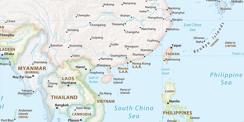
Tian’e Ding, (mountain) is located in Hunan, in China (Asia). It is placed in GMT+8 time zone with current time of 03:14 PM, Thursday. Offset from your time zone: minutes.
| Latitude | 

|
|
| decimal | 25.9361 | |
| DMS | 25° 56' 9.96" N | |
| Distances from | ||
| North pole | 7123.2 km | |
| Equator | 2883.8 km | |
| South pole | 12890.9 km | |
| Longitude | 
|
|
| decimal | 113.52195 | |
| DMS | 113° 31' 19.02" E | |
| Distance from prime meridian: 10847 km to East |
||
List of nearest places sort by population
Hengyang 139 km 319°
319° 177°
177° 252°
252° 308°
308° 190°176°
 139°
139° 153°
153° 303°
303° 290°
290°

Marker is showing location of Tian’e Ding on map(s). You can click on marker if you want to hide it.
 T: 0.01228 s.
2026 © Location.zone | Terms of use | Contact
 52°
52° 9°
9° 171°
171° 36°
36° 66°
66° 109°
109°