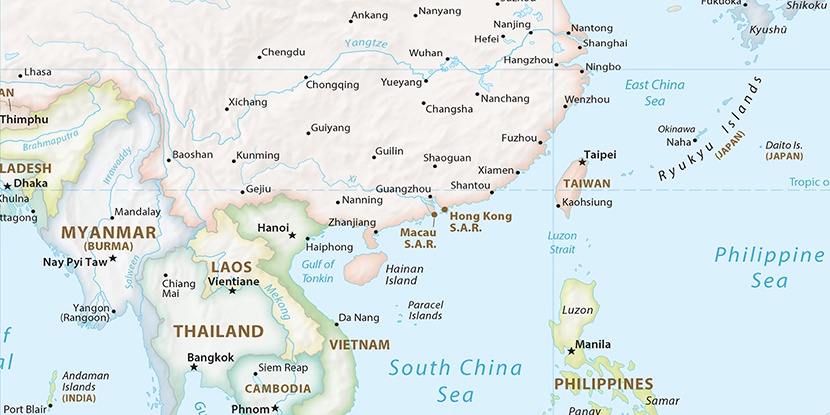
Ch’in-ts’ai-t’ang, (populated place) is located in Yunnan, in China (Asia). It is placed in GMT+8 time zone with current time of 06:12 AM, Saturday. Offset from your time zone: minutes.
| Latitude | 

|
|
| decimal | 22.76389 | |
| DMS | 22° 45' 50.004" N | |
| Distances from | ||
| North pole | 7476 km | |
| Equator | 2531.1 km | |
| South pole | 12538.2 km | |
| Longitude | 
|
|
| decimal | 103.97806 | |
| DMS | 103° 58' 41.016" E | |
| Distance from prime meridian: 10361.9 km to East |
||
List of nearest places sort by population
Wenshan City 72.2 km 22°
22° 326°
326° 308°327°
 320°
320° 353°
353° 343°24°
 60°343°

Marker is showing location of Ch’in-ts’ai-t’ang on map(s). You can click on marker if you want to hide it.
 T: 0.09573 s.
2026 © Location.zone | Terms of use | Contact
 31°
31° 87°
87° 49°
49° 0°
0° 67°
67° 303°
303° 141°
141° 293°
293° 251°
251°