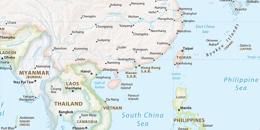
Kengkoudai Muchang, (farm village) is located in Fujian, in China (Asia). It is placed in GMT+8 time zone with current time of 11:17 AM, Thursday. Offset from your time zone: minutes.
| Latitude | 

|
|
| decimal | 27.61778 | |
| DMS | 27° 37' 4.008" N | |
| Distances from | ||
| North pole | 6936.3 km | |
| Equator | 3070.8 km | |
| South pole | 13077.9 km | |
| Longitude | 
|
|
| decimal | 118.62415 | |
| DMS | 118° 37' 26.94" E | |
| Distance from prime meridian: 11038.6 km to East |
||
List of nearest places sort by population
Pucheng 35.1 km 345°
345° 204°
204° 155°
155° 152°148°
 166°166°161°
 184°
184° 143°
143°

Marker is showing location of Kengkoudai Muchang on map(s). You can click on marker if you want to hide it.
 T: 0.02527 s.
2026 © Location.zone | Terms of use | Contact
 34°
34° 227°
227° 219°
219° 307°
307° 280°
280° 1°
1° 65°
65° 295°
295° 287°
287° 110°
110°