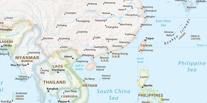
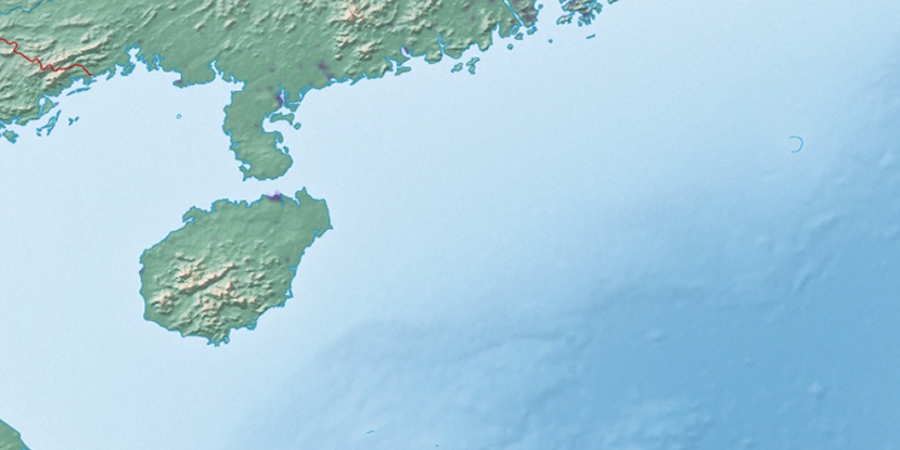
Lingtou Chachang, (farm village) is located in Hainan, in China (Asia). It is placed in GMT+8 time zone with current time of 07:03 PM, Thursday. Offset from your time zone: minutes.
| Latitude | 

|
|
| decimal | 19.04556 | |
| DMS | 19° 2' 44.016" N | |
| Distances from | ||
| North pole | 7889.4 km | |
| Equator | 2117.7 km | |
| South pole | 12124.7 km | |
| Longitude | 
|
|
| decimal | 109.9275 | |
| DMS | 109° 55' 39" E | |
| Distance from prime meridian: 11277.2 km to East |
||
List of nearest places sort by population
Zhongshan 261.7 km 14°9°
14°9° 21°19°
 206°22°9°6°
 119°
119° 345°
345°

Marker is showing location of Lingtou Chachang on map(s). You can click on marker if you want to hide it.
 T: 0.02683 s.
2026 © Location.zone | Terms of use | Contact
 40°
40° 47°
47° 343°
343° 31°
31° 57°
57° 303°
303° 143°
143° 293°
293° 107°
107°