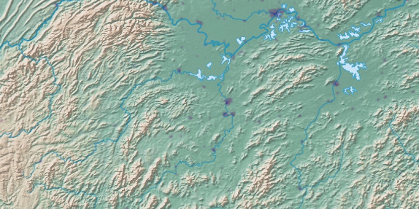
Luhulu Nongchang, (farm village) is located in Hunan, in China (Asia). It is placed in GMT+8 time zone with current time of 02:58 PM, Thursday. Offset from your time zone: minutes.
| Latitude | 

|
|
| decimal | 29.00722 | |
| DMS | 29° 0' 25.992" N | |
| Distances from | ||
| North pole | 6781.8 km | |
| Equator | 3225.3 km | |
| South pole | 13232.4 km | |
| Longitude | 
|
|
| decimal | 112.815 | |
| DMS | 112° 48' 54" E | |
| Distance from prime meridian: 10398.7 km to East |
||
List of nearest places sort by population
Changsha 91.2 km 170°
170° 33°
33° 272°
272° 225°
225° 332°
332° 246°
246° 304°170°
 196°
196° 314°
314°

Marker is showing location of Luhulu Nongchang on map(s). You can click on marker if you want to hide it.
 T: 0.02577 s.
2026 © Location.zone | Terms of use | Contact
 73°
73° 15°
15° 176°
176° 38°
38° 275°
275° 59°
59° 149°
149° 287°
287° 110°
110°