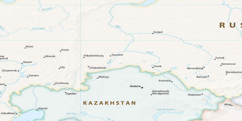
Tamakul’ye, (section of populated place) is located in Kurgan, in Russia (Asia). It is placed in GMT+5 time zone with current time of 06:36 PM, Saturday. Offset from your time zone: minutes.
| Latitude | 

|
|
| decimal | 55.94278 | |
| DMS | 55° 56' 34.008" N | |
| Distances from | ||
| North pole | 3786.8 km | |
| Equator | 6220.3 km | |
| South pole | 16227.3 km | |
| Longitude | 
|
|
| decimal | 64.45389 | |
| DMS | 64° 27' 14.004" E | |
| Distance from prime meridian: 3864.1 km to East |
||
List of nearest places sort by population
Kurgan 77.7 km 134°
134° 287°
287° 206°
206° 179°
179° 9°
9° 140°
140° 100°144°142°136°

Marker is showing location of Tamakul’ye on map(s). You can click on marker if you want to hide it.
 T: 0.02622 s.
2025 © Location.zone | Terms of use | Contact
 269°
269° 282°
282° 94°
94° 251°
251° 240°
240° 263°
263° 111°
111° 232°
232°