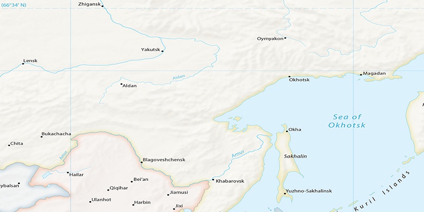
Pad’ Golubaya, (ravine(s)) is located in Amur, in Russia (Asia). It is placed in GMT+9 time zone with current time of 01:04 AM, Sunday. Offset from your time zone: minutes.
| Latitude | 

|
|
| decimal | 51.73191 | |
| DMS | 51° 43' 54.876" N | |
| Distances from | ||
| North pole | 4255 km | |
| Equator | 5752 km | |
| South pole | 15759.1 km | |
| Longitude | 
|
|
| decimal | 127.85292 | |
| DMS | 127° 51' 10.512" E | |
| Distance from prime meridian: 7516.7 km to East |
||
List of nearest places sort by population
Blagoveshchensk 163 km 187°
187° 154°153°
 338°152°149°
 174°
174° 138°
138° 322°323°

Marker is showing location of Pad’ Golubaya on map(s). You can click on marker if you want to hide it.
 T: 0.0282 s.
2025 © Location.zone | Terms of use | Contact
 274°
274° 278°
278° 120°
120°