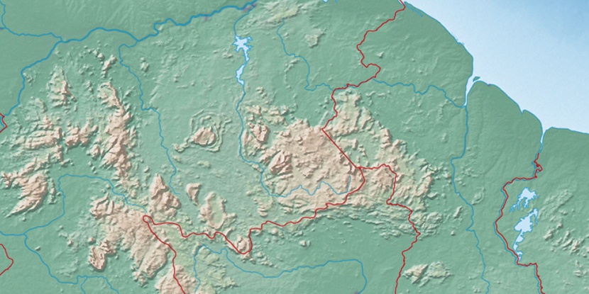
Serra Mariba, (mountain) is located in Brazil (America). It is placed in GMT-4 time zone with current time of 06:45 AM, Thursday. Offset from your time zone: minutes.
| Latitude | 

|
|
| decimal | 4.53333 | |
| DMS | 4° 31' 59.988" N | |
| Distances from | ||
| North pole | 9503 km | |
| Equator | 504.1 km | |
| South pole | 10511.1 km | |
| Longitude | 
|
|
| decimal | -61.25 | |
| DMS | 61° 15' 0" W | |
| Distance from prime meridian: 6786.8 km to West |
||
List of nearest places sort by population
Manaus 859.8 km 170°
170° 161°
161° 175°167°
 231°
231° 153°
153° 196°169°
 212°
212° 217°
217°

Marker is showing location of Serra Mariba on map(s). You can click on marker if you want to hide it.
 T: 0.01066 s.
2026 © Location.zone | Terms of use | Contact
 127°
127° 109°
109° 115°
115° 193°
193° 47°
47° 57°
57° 281°
281° 254°
254°