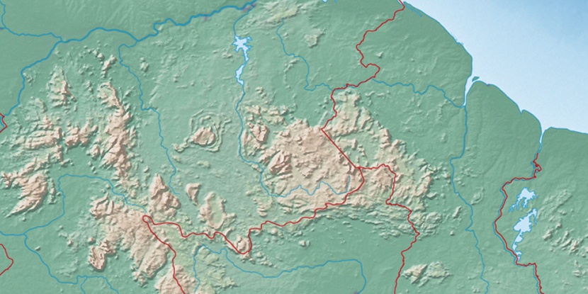
Serra Saporá, (mountain) is located in Roraima, in Brazil (America). It is placed in GMT-4 time zone with current time of 07:44 AM, Thursday. Offset from your time zone: minutes.
| Latitude | 

|
|
| decimal | 4.38333 | |
| DMS | 4° 22' 59.988" N | |
| Distances from | ||
| North pole | 9519.7 km | |
| Equator | 487.4 km | |
| South pole | 10494.4 km | |
| Longitude | 
|
|
| decimal | -60.75 | |
| DMS | 60° 45' 0" W | |
| Distance from prime meridian: 6732.9 km to West |
||
List of nearest places sort by population
Manaus 836.2 km 174°
174° 177°179°171°175°177°
 156°
156° 202°173°
 221°
221°

Marker is showing location of Serra Saporá on map(s). You can click on marker if you want to hide it.
 T: 0.0108 s.
2026 © Location.zone | Terms of use | Contact
 153°
153° 128°
128° 110°
110° 115°
115° 193°
193° 47°
47° 57°
57° 281°
281° 254°
254°