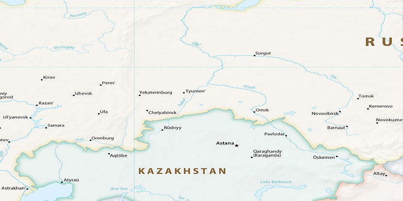
Keushinskiy Rybnyy Uchastok, (populated place) is located in Khanty-Mansiyskiy Avtonomnyy Okrug, in Russia (Asia). It is placed in GMT+5 time zone with current time of 06:35 AM, Thursday. Offset from your time zone: minutes.
| Latitude | 

|
|
| decimal | 61.78333 | |
| DMS | 61° 46' 59.988" N | |
| Distances from | ||
| North pole | 3137.4 km | |
| Equator | 6869.7 km | |
| South pole | 16876.7 km | |
| Longitude | 
|
|
| decimal | 67.53333 | |
| DMS | 67° 31' 59.988" E | |
| Distance from prime meridian: 3388.1 km to East |
||
List of nearest places sort by population
Khanty-Mansiysk 116.7 km 137°
137° 289°
289° 257°
257° 348°
348° 314°309°
 265°259°313°
 315°
315°

Marker is showing location of Keushinskiy Rybnyy Uchastok on map(s). You can click on marker if you want to hide it.
 T: 0.02161 s.
2026 © Location.zone | Terms of use | Contact
 248°
248° 129°
129° 215°
215° 227°
227° 155°
155° 237°
237° 205°
205° 119°
119°